Visit Logged
  • Select Region
    • All Regions
    • VA to NC Line
    • North Carolina
    • South Carolina
    • Georgia
    • Eastern Florida
    • Western Florida
    • Florida Keys
    • Okeechobee Waterway
    • Northern Gulf
    • Bahamas
    • New York
    • Ohio
    • Pennsylvania
    • Washington
    • Puerto Rico
    • Minnesota
    • Maryland
    Order by:
    • LNM: High Water Event, Upper Waccamaw River, SC

      This high water has prompted the USCG to declare a strict no-wake zone from statute miles 375-366. See Strict No-Wake Zone. Our thanks to Jim Healy for this notice.

      The Coast Guard has declared a “HIGH WATER EVENT” for the Upper Waccamaw River in South Carolina. Officially, the affected zone starts an Wacca Wacha Marina and runs through Myrtle Beach, and includes the Upper Waccamaw to Conway, SC. But is fact, it will affect everyone from Georgetown through Myrtle Beach.

      The ICW is above flood stage. The fixed docks at Buicksport Marina (Bucksport sausage) are under water. Because of the flooding, there isn’t much tide in this area, but there is a nasty 3-1/2 to 4 knot current on the Waccamaw that has a big effect on slower boats. We normally make 8-1/2 StM/Hr through still water; yesterday in places, 5-1/2 StM./Hr at higher engine RPM than usual. The marina folks here are saying the crest of the flooding is expected this coming Saturday (6/6/2020).

      We have not traveled farther than Socastee, SC (Osprey Marina), but immediately North of Osprey is an area where houses are flooded by the high water. Some bridges (RR, not on the ICW) are locked closed. The USCG LNM is reminding boaters that they are responsible for their wakes, as water is into home is some places. And, I should make honorable mention, there is large flotsam in the water. Watch for logs. Sailboats, make sure you can clear the fixed bridges on the Waccamaw and the ICW through Myrtle Beach. There is one sailboat at Osprey that cannot make the bridges, so he’ll be stuck for a while.

      Jim

      Peg and Jim Healy, living aboard Sanctuary

      0 Facebook Likes, 1 Facebook Reactions

      Be the first to comment!

    • Praise for Myrtle Beach Yacht Club and Osprey Marina, AICW Statute Miles 346 and 373


      Osprey Marina

      Our thanks to Hubert Hopkins for permitting us to post his kind words from AGLCA’s Forum for two CRUISERS NET SPONSORS, Myrtle Beach Yacht Club on the northerly banks of Coquina Harbor and Osprey Marina at mile marker 373 on the ICW south of Myrtle Beach, SC.

      There are so many nice, convenient marinas in the Myrtle Beach area. My three favorite are The Myrtle Beach Yacht Club which is in North Myrtle Beach. It’s a great marina, right on Hwy 17 and convenient to many things. To me it feels like a marina, not really a “Yacht Club”, very welcoming to transients and affordable. Next is Wacca Wacce, which you had a recommendation on. A third which is just a little North of Wacca Wacce is Osprey Marina. They are the nicest people and a quiet little marina. Not as convenient as the other two, but if you have a rental car would be just as good. No restaurant close by is the biggest drawback. There are also some high-end resort marinas around like Grand Dunes and Barefoot Yacht Club if you want. Have fun!
      Hubert Hopkins

      Click Here To View the South Carolina Cruisers Net’s Marina Directory Listing For Myrtle Beach Yacht Club

      Click Here To Open A Chart View Window Zoomed To the Location of Myrtle Beach Yacht Club

      Click Here To View the Cruisers Net South Carolina Marina Directory Listing For Osprey Marina

      Click Here To Open A Chart View Window, Zoomed To the Location of Osprey Marina

      5 Facebook Likes, 5 Facebook Reactions

      Be the first to comment!

    • Praise for Osprey Marina, AICW Statute Mile 373


      Osprey Marina

      A CRUISERS NET SPONSOR, popular Osprey Marina is at mile marker 373 on the Intracoastal Waterway south of Myrtle Beach, SC. Thankfully, Osprey Marina has almost completely recovered from the damages of hurricane Florence. Our thanks to Loopers Steve Quinn and Brenda Sanderson for these good words as posted on AGLCA’s Forum.

      I needed about three weeks of harborage myself in the same area so I chose Osprey Marina. Great folks, clean family run marina and very well protected. I called pretty much last minute to make reservations and they did work me in. Highly recommended. I will be returning to my boat approximately May 10.
      Steve Quinn

      2nd Steve Quinn’s recommendation. if you can go North a little more, you won’t find much of a friendlier and well protected marina. Last trip through southbound, they paid two dock hands OT to receive us an hour after closing to make sure we made it in. Cheap diesel too. We love Osprey. On our way north recently we stopped to fuel and pump out at Wacca Wache. Over 25 cents more per gallon on diesel than Osprey and a whopping $25 for a pumpout.
      Brenda Sanderson

      Click Here To View the Cruisers Net South Carolina Marina Directory Listing For Osprey Marina

      Click Here To Open A Chart View Window, Zoomed To the Location of Osprey Marina

      7 Facebook Likes, 7 Facebook Reactions

      Be the first to comment!

    • Boat Goats and Good Words for Osprey Marina, AICW Statute Mile 373


      A CRUISERS NET SPONSOR, popular Osprey Marina is at mile marker 373 on the Intracoastal Waterway south of Myrtle Beach, SC. Thankfully, Osprey Marina has almost completely recovered from the damages of hurricane Florence. Our thanks to Timothy Gaffney for these kind words and to Tricia Beck True for the photo as posted on B0b423.

      Boat Goats Photo by Tricia Beck True

      We left Osprey last Thursday and the goats had just finished trimming the bushes by the office.
      Fantastic Marina! They really took great care of our boat before, during and after Flooding Florence.
      Timothy Gaffney

      Click Here To View the Cruisers’ Net’s South Carolina Marina Directory Listing For Osprey Marina

      Click Here To Open A Chart View Window, Zoomed To the Location of Osprey Marina

      Be the first to comment!

    • Sherer Report: Osprey Marina to Heritage Plantation, AICW Statute Mile 373-395


      Osprey Marina

      Our thanks to authors/cruisers Robert and Ann Sherer for sharing observations and photos of their voyage south this Fall. Osprey Marina, A CRUISERS NET SPONSOR, is at mile marker 373 on the Waterway south of Myrtle Beach, SC.


      Robert Sherer
      Admin · Yesterday at 7:04 AM
      Came down the Waccamaw yesterday from Osprey Marina to Heritage Plantation since we couldn’t get a dock at Georgetown due to their annual wooden boat show. The river had very little debris, I would say about average except for one large log just south of Osprey that had a red float tied on.

      The marina here has a large facedock, easy in and out. A nice place. Today I tackle McClellanville!

      Click Here To View the VA to NC Cruisers’ Net Marina Directory Listing For Heritage Plantation

      Click Here To Open A Chart View Window Zoomed To the Location of Heritage Plantation
      o

      2 Facebook Likes, 2 Facebook Reactions

      Be the first to comment!

    • Georgetown, SC – Best Coastal Small Town, AICW Statute Mile 403


      VHF 16 & 68 Located on the Sampit River, Harborwalk Marina is only a boardwalk away from Georgetown's Historic District, great food, shopping, etc. A safe harbor from bad weather and located in calm

      Congratulations to Georgetown, A CRUISERS’ NET SPONSOR, home to Harborwalk Marina, also A CRUISERS’ NET SPONSOR, only a boardwalk away from Georgetown’s Historic District for history, entertainment, great food, and shopping! This recognition as Best Coastal Small Town is certainly well deserved! For more on Georgetown, go to FOCUS ON.

      Georgetown wins ‘Best Coastal Small Town’ from USA Today

      GEORGETOWN, SC – South Carolina’s third oldest city is America’s No. 1 coastal town, according to USA Today and 10Best Reader’s Choice voters.

      CLICK HERE FOR THE FULL ARTICLE

      Click Here To View the Cruisers’ Net’s South Carolina Marina Directory Listing For Harborwalk Marina

      Click Here To Open A Chart View Window, Zoomed To the Location of Harborwalk Marina

      1 Facebook Likes, 1 Facebook Reactions

      Be the first to comment!

    • Healy Report: Socastee to Isle of Palms, SC, AICW Statute Miles 410-457


      Isle of Palms Marina is located on the east side of the Intracoastal Waterway, northeast of Charleston at Mile 456.5 and south of ICW Marker 116. 50 41st Avenue

      This leg of Jim and Peg Healy’s sojourn through South Carolina begins in the Waccamaw River, south to Winyah Bay, then turns west into Estherville Minim Creek and ends on Isle of Palms, home to CRUISERS’ NET SPONSOR, Isle of Palms Marina. Again, our sincere thanks to these very experienced cruisers for sharing their experiences and expertise with all of us.
      The southbound minimally marked entrance to Minim Creek from Winyah Bay requires careful lookout or you will pass it, especially on an outgoing tide. And as a sidebar on Minim Creek, see Minim Creek Ferry.

      Sanctuary and crew traveled south from Socastee, SC, on the Waccamaw, to Mt. Pleasant, SC, on Tuesday, 10/17/2017. Low tide in the region was early afternoon (13h30). The entrance to the Estherville-Minim Canal at Winyah Bay is very shoal for at least the first 1/2 mile. The Esterville-Minim Creek Canal and the Fourmile Creek Canal have both continued to shoal. We saw spots at 6-1/2 ft at 1/3 tide.

      We managed – poor planning – to arrive at McClellanville at dead low tide (10/17/2017, 13h51, +0.1 ft above MLLW). Our depth sounder transducer is 30” below the waterline, and it quits when it get’s to 2 to 2-1/2 ft above a soft bottom or weeds. Today, it quit. So, I don’t know how deep the water really is. What I do know is, Sanctuary draws 4-1/4 ft. What I learned for certain is, the bottom of the ICW around McClellanville is soft mud. I had slowed to just above idle, (never approach anything faster than you’d want to hit it). We never got stopped making way, but there were spots where I could feel the soft mud throwing the boat around. One of many times I really, really liked having a single engine boat with a prop and rudder protected by a beefy full keel. We never encountered anything hard; nothing that went “bump” along the hull. The stretch between G”35″ and R “48” is definitely the worst long stretch (4 miles) on the ICW at this point. Not bad when the tide is in, but 4 ft or less at low tide, and worse yet if celestial low tide. Southbound, check the tide station called “McClellanville, Jeremy Creek” before departing (or passing by) Georgetown. To stay clear of the McClellanville mud at MLLW, ditch out up above McClellanville and wait for a better tide if you’ll arrive at low and your boat draws more than 3 ft.

      Those who have done this stretch of South Carolina ICW in the past know there are some very impressive, long docks extending from shore. Many show signs of very significant storm damage. Several that had nice multi-deck sun shelters top were tipped over and lying in the water (well, lying in the mud at low tide). Many of the docks and access-ways had decking missing, we assume from waves and high water lapping at them from beneath. We saw sunken floats and many pilings askew. We did not see any flotsam, but I would definitely keep a sharp lookout throughout the region. Crab pot floats are everywhere. In fast currents, floats bob underwater. Be on the lookout…

      There has been generally more transient boat traffic than I expected this early in the season. Don’t know if that predicts more traffic later, or maybe they’ve all already come through, so slower later??? The big go-fast boats we’ve encountered have generally been gentlemen about passing, but it’s on you if you’re a slow boat to keep a sharp eye out astern for approaching, overtaking traffic.
      Jim

      Peg and Jim Healy aboard Sanctuary, currently at Rock Creek, Pasadena, MD
      http://gilwellbear.wordpress.com
      Monk 36 Hull #132
      MMSI #367042570
      AGLCA #3767
      MTOA #3436

      Click Here To View the South Carolina Cruisers’ Net Marina Directory Listing For Isle of Palms Marina

      Click Here To Open A Chart View Window, Zoomed To the Location of Isle of Palms Marina

      For a complete list of Sponsoring Marinas along this route, go to SC SSECN Sponsoring Marinas

      Be the first to comment!

    • Photo Journal Update – Waterway Bridges by Bill Murdoch

      Waterway construction can provide welcomed distraction as well as navigational concerns. Bill Murdoch sends beautiful photos of four bridge constructions/removals currently ongoing from Myrtle Beach to Miami. And “one picture is worth a thousand words!”

      Thank you Bill!

      The bridge construction in Myrtle Beach is moving along apiece with staging extending in to both sides of the waterway. One photo [below] is as we were passing through the construction area and the other photo is taken over our stern looking north at the bridge. (2/1/17)

      Carolina Bays Parkway Bridge

      See /162534

      The old bascule bridge at Sisters Creek is almost no more. Traffic is on the new span, and crews are working both above the water and below to remove the old bridge. We squeezed through the gap between the construction barge and the red side fendering. (2/11/17)

      Memorial bridge in Daytona is almost gone as well. It was a little confusing to figure out where we should pass through the construction work, but in the end we went through the old partially destroyed fendering system with no problem. (2/13/17)
      Our confusion at the Daytona Memorial Bridge came from both a tool box and from the general state of disarray in the construction area. A Greenlee tool box seen end on looks quite like a green daymark.

      This time it is Flagler Memorial in Palm Beach. They have been replacing this bridge for a couple of years. It is sort of like building a new school house on the site of the old school house with school still in session… it is a mess. Anyway, on February 21 we arrived at Flagler Memorial Bridge in Palm Beach right as the span was closing. After an hour wait, the bridge (one leaf) opened for us, and we passed through. It was a tight fit. The old bridge support and its fender system were to starboard, and the closed leaf was close by to port. Here is a picture of the bridge after we have come through. Sorry for the drab photo; it was not a Kodak day.

      Click Here To Open A Chart View Window, Zoomed To the Location of SC31 Bridge Site

      Click Here To Open A Chart View Window, Zoomed To the Location of Sisters Creek Bridge

      Click Here To Open A Chart View Window, Zoomed To the Location of Memorial Bridge

      Click Here To Open A Chart View Window, Zoomed To the Location of Flagler Memorial Bridge

      Be the first to comment!

    • Added Water Heights Add Question Marks to Fixed Bridge Clearances in NC and SC

      This article by Audrey Hudson of the Myrtle Beach Online relates problems not only for communities along the Waterway, but for boaters as well. Along with debris, floating and submerged, air clearances at fixed bridges become concerns with the added water heights.

      Waccamaw River crest to topple record that has stood since 1928
      The Waccamaw River crested in Conway late Monday at 17.9 feet, toppling the record set in 1928 from the rain unleashed by Hurricane Okeechobee.
      The 1928 flood is listed as one of the state’s “storms of the century” by the S.C. Department of Natural Resources, with rainfall of 10 to 12 inches that topped the Waccamaw at 17.8 feet above flood level. Road, bridges and railways were impassible, and property losses were nearly $6 million.

      The river’s third-highest crest was set by Hurricane Floyd in 1999, and last year’s record rainstorm is now fourth.

      The slow-moving river took nine days to hit the mark following Hurricane Matthew, and officials say it could take just as long for the water to finally recede back to moderate flood stage levels.

      Residents near Conway started preparing for the coming flood the morning after Hurricane Matthew hit, and roads were cut off by water the following Monday.

      Residents in areas that have never flooded before along the Intracoastal Waterway and in Bucksport were evacuated days later as the water crept to the crest.

      The Intracoastal Waterway was at 19.09 feet over flood stage by Monday.

      The code red emergency call system was activated Saturday to alert Socastee residents by phone about the rising waterway, and a voluntary evacuation was urged.

      Bucksport residents — at risk from the Intracoastal Waterway, Waccamaw and Little Pee Dee River flooding — were alerted on Friday, said Brooke Holden, communications specialist for Horry County Emergency Management.

      “We wanted to make sure those people knew that if they wanted to leave or felt the need to leave, now was the time to go,” Holden said.

      There are seven shelters still operating in Horry County for residents who have evacuated flooded areas: at Aynor High School, Conway High School, Green Sea Floyds Middle and High schools, Loris High School, North Myrtle Beach High, Palmetto Bay Elementary School and Whittemore Park Middle School, according to the Emergency Operations Center.

      “People need to know there is still somewhere for them to go,” Holden said.

      With more than 100 roads closed throughout the county due to flooding and the Waccamaw River just hitting its peak, it will be several days before local, state and federal officials can access the areas to assess the damage and finalize requests for federal assistance from FEMA.

      “Just like last year, it’s going to be a waiting process,” Holden said.

      Once the river crests, it takes the crawling Waccamaw days, sometimes more than a week, to recede to the point that homeowners can access their property and assessments can be made.

      Those assessments must be made before FEMA determines whether to grant the state’s request that Horry County be declared an emergency area.

      “It’s a process that has to go to the White House for the president to approve,” said Derrec Becker, public information officer with the state Emergency Management Division.

      “Horry County is still in response mode with the oncoming flood. Because it’s an ongoing emergency situation, we are focused on life and safety first, and then recovery,” Becker said.

      Audrey Hudson: 843-444-1765, @AudreyHudson

      Read more here: http://www.myrtlebeachonline.com/news/local/article108738657.html#storylink=cpy

      Comments from Cruisers (1)

      1. Bob Sadler -  October 28, 2016 - 3:42 pm

        Last year we were stuck for almost a week at Barefoot Landing due to flooding. Our mast height is 62′ and many, almost all the ’65’ bridges lacked height boards so we had to rely on other boaters to help us out…I suspect that same situation is true this year as well.

        Reply to Bob
    • Cook with Cruising Kiss, available at Bucksport Marina, AICW Statute Mile 377


      Author Corinne Kanter has these suggestions to make your culinary summer delightful and delicious! Bucksport Marina, A SALTY SOUTHEAST CRUISERS NET SPONSOR!, lies south of Waterway marker #36, along the western shores of the beautiful Waccamaw River. As well as making sausage, Bucksport is hosting one more drag boat race this summer in September, as well as a reduced dockage rate for SSECN readers.

      If you are inside and near Bucksport Marina, pickup Bucksport Sausage.
      Need more helpful hints, you should carry the cookbook CRUISING KISS, keep it simple Sailor? Stupid? or really SYSTEM.
      Have a great race. Cook with KISS.
      PS. If you would like a autograph copy order direct or get it on Amazon. Corinne had the column in Multihull Magazine out of Quicy, Mass. titled Corinne’s Culinary Corner.

      Cook With K.I.S.S.
      Corinne Kanter, author of The Cruising KISS Cookbook
      www.sailcopress.com
      The Rooster Crows but the HEN delivers the goods
      corinnekanter@gmail.com

      Click Here To View the Cruisers’ Net’s South Carolina Directory Listing For Bucksport Marina

      Click Here To Open A Chart View Window, Zoomed To the Location of Bucksport Marina

      Be the first to comment!

    • Herl Report: Osprey Marina, AICW Statute Mile 373


      Osprey MarinaOsprey Marina lies at the southern foot of AICW section known officially as the Pine Island Cut (a. k. a. “the Rock Pile”), just as the Waterway sweeps south into beautiful Waccamaw River. Osprey Marina is one of the finest marinas you will ever discover, and these good folks are A SALTY SOUTHEAST CRUISERS’ NET SPONSOR!


      Osprey Marina
      Arrived for fuel and to get tucked in for the weekend or until the circulation in the Atlantic has cleared the area. Topped off the tanks and while just holding the nozzle was talking to Miles. We both have the gout word in common. Once we were fueled and docked Miles said he would drive us to the clinic so I could get some medication. Thank You, Thank You Miles. I think I’m on the mend.
      As always Osprey has been great taking care of us.
      Day three and the rain is still falling in large quantities. So to pass the morning we gather for free coffee and snacks and conversation. Watching the bad weather shifting south, not good for anyone traveling south. I think we will stay a while longer.
      10/5/15 Monday. It is Monday and all the water is high, so anyone between Southport area and Charleston area, if you are in a spot you can stay, stay where you are it is not safe on the ICW with all the trash floating in the water. Be safe. We are talking to others in the Marina and we are all staying put for now.
      Phil and Sandy Herl

      Click Here To View the Cruisers’ Net’s South Carolina Marina Directory Listing For Osprey Marina

      Click Here To Open A Chart View Window, Zoomed To the Location of Osprey Marina

      Be the first to comment!

    • Detailed Description of Upstream Waccamaw Trip to Conway, SC, off the AICW


      Skipper Winter does indeed complement an earlier posting by Jim and Peg Healy, /?p=138583. Our thanks to John and Sue for this detailed narrative of their recent trip upriver to Conway. The upper portion of the Waccamaw River departs the Waterway at statute mile 375.

      To hopefully complement Sanctuary’s posting, we just finished going to Conway and made the following notes. One can take these and mark the Healy’s maps, and add milage to them. the distances are not off more than a tenth at each junction: From ICW MM 375 just south of ICW marker `27A’:
      This is the last posting on any web sites that I have seen with any detail. We traveled this river this week and it is still a beautiful trip and well worth the extra time. It is even more beautiful than the lower Waccamaw. First, the Corps of Engineers have removed all markers above `R4’, and as such, there are a few spots that are confusing as to where to turn. Lastly, different postings on various web states the distance to downtown Conway anywhere from 12 to 16 miles without stating whether they are nautical or statute miles. Reset your odometer to `0’ for the following information. We use statute miles. From `G1’, the entrance marker, it is 14.3 miles to the last bridge (you do not want to go under that in a larger boat) and about 14 miles to the marina entrance basin. Just as Sanctuary recommends, go to the bridge to dock since it is an easy walk to town. The two floating docks are in decent shape, but the cleats are still a little loose, but there is no traffic or winds to bother you and if there was a huge blow, there are alternatives to tie up soundly ‘“ easy. The electric is still there but still no water. Call the marina for space (room for a 60′ boat at each dock, maybe longer). Also, repeating, when going into a curve, stay to the outside where the water is deeper. We entered at dead low tide (on purpose) so as to make better notes. The NOAA charts that end just above `R4’ are accurate. We saw 11-13′ at `G1’ and then before the first curve, 7.9′. After the first curve, it deepened to 9.0′ Just prior to the second curve, briefly 5.9′, but we were too much inside on the curve. Coming back down, we had over 7.5′. Hug `R2’. First curve after `R2’ was 8.3′. From here you will see depths well over 20′ in places. Just prior to `G3’, which is 1.9 miles in, 6.5′ and quickly deepens to 30’. MM 2.1 you’ll see many stumps on the RDB, but 8.1 feet as charted. MM 3.0 (`R4’) stay left at these intersections. MM 4.3, there are power lines that we do not know the height, but any motor boat will have no problems, but sailboats may (this statement applies to all power lines mentioned). They all appear to be well over 45′, but who knows. MM 4.7 at a private dock, make a left turn (it’s not obvious). MM 5.2 shallows to 8.6′ briefly. At MM 5.9, make a sharp left. MM 6.1, there are some nice homes to see, watch your wake. MM 6.9, favor RDB (starboard) for deeper water (7.5′, otherwise 6.0′). MM 7.6 some more homes. MM 9.4 is interesting. There is an upside down arrow sign that has the word `only’ upside down on it. Do not think this sign is upside down, it’s not. Whoever put it up, obviously did not have the correct sign. Make a sharp left here (yes, to port). If you go right, you hit bottom (we know ‘“ LOL). MM 10.0, another left turn where there is yet another upside down `only’ sign. MM 10.4-11.0, shallows to 7.4′ (this is where the river gets a little wider, so it makes sense the water would be shallower). MM 11.1 favor RDB where you get over 11′. Center is as low as 5.2’. MM 11.6, turn left. MM 12.1 is 6.6′ and there might be a very interesting river boat moored there. MM12.3, turn left at homes and docks. MM 13.2, overhead power lines. As you get to a high bridge, you are entering Conway. From here on in, it is no wake. You will see to your left the entrance to the marina basin around MM 13.9. Go past this to the floating docks on your left. They are obvious, just before the bridge. Call the marina for docking, but if no answer, don’t panic. If you are there just for a few hours, docking is free. The river walk is beautiful, and many great places to eat and shop. See the college (Coastal Carolina) ‘“ it is also very nice. One could easily stay here for a few days, so if the weather is not so good, and you have stopped at Georgetown enough, then this is the place for you. It takes about 2.5 hours (max) to do the river one way on a trawler.
      Sue and John Winter on Just Relax (MTOA, Golden Loopers, AIWA members)

      Click Here To Open A Chart View Window, Zoomed To the Location of Upper Waccamaw/AICW Intersection

      Click Here To View the Cruisers’ Net’s South Carolina Marina Directory Listing For Conway City Marina

      Be the first to comment!

    • Help Needed with Bucksport Sausage! Bucksport Marina, Waccamaw River, SC, AICW Statute Mile 377


      We get a lot of requests for assistance on various aspects of boating and navigation, but this question is certainly one for the books. So come on all you noble Southern Sausage Chefs, lets hear your method of cooking the famous Bucksport Sausage! Bucksport Marina, A SALTY SOUTHEAST CRUISERS NET SPONSOR, is located south of Waterway marker #36, along the western shores of the beautiful Waccamaw River.

      My son Jeff Meyer brought me a Bucksport sausage and I have never seen one like it before.
      I have no idea how to cook it. Where can I find directions, I need help.
      June Dienes

      Click Here To View the Cruisers’ Net’s South Carolina Directory Listing For Bucksport Marina

      Click Here To Open A Chart View Window, Zoomed To the Location of Bucksport Marina

      Be the first to comment!

    • Sandy Island, SC, Gets New School Bus Boat, near Georgetown, SC

      School is in session for all ages and all places, even islands! But this “school bus” is one you may not know about, so Watch Your Wake! Sandy Island is the name of a small unincorporated community in Georgetown County, South Carolina. This article by Erin MacPherson is from WPDE.com.

      New andy Island School Bus Boat

      New Sandy Island School Bus Boat

      schoolboat2

      New Sandy Island School Bus Boat

      Sandy Island gets new school bus boat
      by Erin MacPherson
      Posted: 08.05.2015 at 6:11 PM
      For years, the Sandy Island community and Georgetown County School officials have wanted a new school boat to get students who live on the island to and from school. The boat they were using was from 1964. And now, they have a new one. “It transports students just like a bus from Sandy Island to the mainland and then we put them on a bus and take them to school,” said Dr. Randy Dozier, Georgetown County Superintendent.
      The New Prince Washington is the state’s only school boat.
      Dr. Dozier says the boat they used before this one was outdated.
      “It was fairly slow, not as accessible and harder to operate. We wanted to bring it up to speed and make it safer more modern. Now we have a boat specifically for that and it’s brand new,” said Dozier.
      Dozier says the school board understood how important this boat is for the students on Sandy Island.
      “I have ridden on the old boat; it’s not a satisfactory trip. It’s a safe trip but it’s just crowded and old. This new boat is so much better and I can’t wait to ride on it,” said Richard Kerr, a trustee with the Georgetown County School Board.
      But getting this new boat wasn’t an easy task. Dozier says it’s all thanks to State Superintendent Molly Spearman.
      “This is owned by the state department much like a school bus. They maintain it. We provide the pilot, they provide the base salary, and we supplement that,” said Dozier.
      Tuesday, the boat passed the Coast Guard’s inspection.
      It seats 12 people, has a place for the pilot and co-pilot, and it has tie downs for wheelchairs.
      Dozier says it can safely fit 16 people and has plenty of life jackets for all passengers.
      “It looks great and meets all specifications,” said Dozier.
      The New Prince Washington will have its first launch on the first day of school.
      There’s no word yet on what they’re going to do with the old school boat.

      Be the first to comment!

    • Free Thanksgiving Meal at Bucksport Marina, AICW Statute Mile 377


      Bucksport Marina, A SALTY SOUTHEAST CRUISERS NET SPONSOR!, lies south of Waterway marker #36, along the western shores of the beautiful Waccamaw River. This generous free meal is typical of the concern always shown for their boating visitors at this unique and fine marina. Plus a reduced rate for SSECN readers.

      Hey Everybody,
      The Grand Opening of Captains Seaweeds Restaurant & Tiki Bar presents a Special Thanksgiving Day Meal!!
      The meal is free which will be Turkey and all of the trimmings.
      The Bar will be open for business. (Come Meet The New Bartender and Staff)
      This is a new beginning for Captain Seaweeds, Under new and energized ownership.
      Please checkout the New Menu and The Hours of Operation that will be Consistent with Customers needs.

      Reduced Fall and Winter Campground Rates are in effect.
      Many New and Exciting Activities and Events are being planned.
      Examples but not limited to are:

      Competition Volleyball Tournaments, Putt Putt Tournaments, Drag Boat Races, Wakeboard Tournaments, Pool Tournaments, Concerts, Bike Swap Meets, Watercraft Rentals, Kayaking and Tours, Jet Skiis, Air Hockey, Darts, Dancing, Corn Hole, Horse Shoes, Classic Cars Shows, Corvette Shows, Fishing Tournaments, Football/Basketball/ Sports Parties and Socials, Weddings and Receptions, Birthday Parties

      A new Website is almost up and running with constant updates (www.bucksportplantation.com)

      We offer boat and watercraft storage ($75 MONTHLY)
      Plus a special rate of $1.00 per foot per night if you say you saw this posted on Cruisers Net.
      We offer long and short term Wet storage as well.
      Reduced RV REPAIR rates for our customers
      Watercraft Mechanic services are now available as well for our customers.

      Please call for more information or for Reservations!!
      Thanks,
      Jeff Weeks
      Manager
      Bucksport Plantation Marina & RV resort
      843-397-5566
      bpmrvss@gmail.com

      Click Here To View the Cruisers’ Net’s South Carolina Directory Listing For Bucksport Marina

      Click Here To Open A Chart View Window, Zoomed To the Location of Bucksport Marina

      Be the first to comment!

    • A SC Waterway Mini-Guide from Little River Inlet to Beaufort, AICW Statute Miles 349-517

      Many thanks to Skippers Lunsford for providing very recent reports from six shoaling areas between Myrtle Beach and Beaufort. Three of these areas have been designated SSECN Problem Stretches and their descriptions are listed below.
      For a recent report on McClellanville, see /?p=144354
      For a 2013 ACOE survey of area north of Ben Sawyer Bridge, see /?p=125717
      For a 12/2013 report on Ashepoo-Coosaw Cutoff, see /?p=129101
      For an alternative to Ashepoo-Coosaw Cutoff, see /?p=134342

      Hi there. We just came through this area in the last week, a bit ahead of the pack, so thought we’d pass on what we found at the traditional trouble spots to help those who come behind us (a copy of what we posted on a couple of Facebook groups). Thanx for all you do.
      Dan and Jaye Lunsford

      SM 349-352 The Rockpile: This stretch has numerous rock ledges on the sides of the channel so its important to stay in the middle. Not quite as scary as it sounds, but its the first time on the journey that the ICW is anything but mud if you do make a mistake. The ledges are very easy to see at low tide, and there is plenty of water depth even at the lowest tide. On weekends it can be crowded with power boats who may want to pass you if you are a slower sailboat and there really isn’t a lot of room to move over.

      SM 430-435 McClellanville: Time the tides here if at all possible. If you’re really motivated you can tiptoe your way through; we saw 6′ MLLW, but so much simpler to just give it a couple of hours.

      SM 460 shoals before Ben Sawyer bridge: 4′ MLLW, so its really important to time the tides here. Favor the north side of the channel from before G117A to G119.

      SM 471 Wappoo Creek Bridge: This operator is REALLY a stickler for time; bridge is closed during rush hour opens every 1/2 hour during the middle of the day (check the complex operating schedule) but if you aren’t waiting at the bridge before the opening, the operator will not hold even a moment but will make you wait for the next one.

      SM 501-504 Watts Cut: Although not listed as a traditional trouble spot, there are numerous shoals to 6′ MLLW along this reach. In a slow sailboat it’s hard to time the tides to have water here, and also water at the next trouble spot.

      SM 517 Ashepoo-Coosaw Cutoff: Stay at least a couple of boat lengths off G177 at the entry (“square the corner”) for 10′ MLLW. At the exit, R184 was reported destroyed; a new temporary drop aid (floating can) was placed there on Friday — we met the Coast Guard small boat that was doing the work on their way back. Slightly favor that NW side between R184 and G185, but time the tides if necessary, we saw 5′ MLLW here briefly.

      Click Here To View the Cruisers’ Net’s “AICW Problem Stretches” Listing For the Waterway south of McClellanville to Awendaw Creek

      Click Here To Open A Chart View Window, Zoomed To This AICW Problem Stretch

      Click Here To View the Cruisers’ Net’s “AICW Problem Stretches” Listing For the AICW North of Ben Sawyer Bridge to Isle of Palms Bridge

      Click Here To Open A Chart View Window, Zoomed To This AICW Problem Stretch

      Click Here To View the Cruisers’ Net’s “AICW Problem Stretches” Listing For the AICW/Ashepoo Coosaw Cutoff Problem Stretch

      Click Here To Open A Chart View Window, Zoomed To This AICW Problem Stretch

      Be the first to comment!

    • Rate Reduction for SSECN Readers at Bucksport Marina, AICW Statute Mile 377


      Bucksport Marina, A SALTY SOUTHEAST CRUISERS NET SPONSOR!, lies south of Waterway marker #36, along the western shores of the beautiful Waccamaw River. This reduced rate is good news for all you Snowbirds, especially at this unique and fine marina.

      Jeff Weeks, the new marina manager of Bucksport Marina, is offering readers of the Cruisers’ Net a special dockage rate of $1.00 dollar per foot if the skipper says he saw it on SSECN.
      Jeff can be reached at bpmrvss@gmail.com or (843) 397-5566.

      Click Here To View the Cruisers’ Net’s South Carolina Directory Listing For Bucksport Marina

      Click Here To Open A Chart View Window, Zoomed To the Location of Bucksport Marina

      Be the first to comment!

    • A Good Visit to Bucksport Marina, AICW Statute Mile 377


      At Bucksport cruising visitors will discover all new docks, new power pedestals, a newly reopened on-site restaurant, clean '“ climate controlled showers and laundromat, as well as a warm welcome for the cruising communityMany good words about newly renovated (and under new ownership) Bucksport Marina and their on-site restaurant, continue to be recorded here on the Cruisers’ Net! And, of course, these good people are a SALTY SOUTHEAST CRUISERS NET SPONSOR! PLEASE patronize them and all our other sponsors whenever possible! Bucksport Marina lies south of marker #36, along the western shores of the AICW/Waccamaw River.

      We stayed 5/30/14 on our way south. Jeff Weeks the marina manager was very helpful and we were pleased with our stay. We will stop in again.
      Doyle Evans

      Click Here To View the Cruisers’ Net’s South Carolina Directory Listing For Bucksport Marina

      Click Here To Open A Chart View Window, Zoomed To the Location of Bucksport Marina

      Be the first to comment!

    • Cruising the Upper Waccamaw River, off the AICW to Conway, SC

      This wonderful article by long-time cruisers and long-time friends, Peg and Jim Healy, is from their blog “Cruising Aboard Monk 36 Trawler Sanctuary, Cruising Adventures in Another Life.”

      sanctuary

      Conway, SC; Upper Waccamaw River

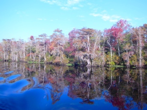
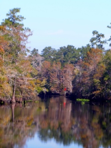
      DSCN1074Sanctuary and crew made our first visit to Conway, SC, on the Upper Waccamaw River, on October 29 and 30, 2013. On the advice of the dockmaster at Osprey Marina, we departed the ICW at Enterprise Landing, at daymark G’1.’ The channel in that area is narrow, and shoals to 7-1/2 feet for a short distance. Once past that area, the river widens and become a magnificent cypress swamp meandering stream. Navigation planning was only slightly more complicated than usual. `Standard’ NOAA charts do not cover the upper Waccamaw. The rule is, as always when upbound, `red, right, returning.’ The river is adequately marked with clearly visible daymarks. Navigation is straight forward. We stayed to the middle of the river on longer, straighter stretches, and favored the outside radius of turns and switchbacks. From the ICW at Enterprise Landing to Conway, a cruise of approximately 16 StM, there are three shoal areas: first, just above G’1,’ second, in the vicinity of R’12,’ and third, in the vicinity of R’16.’ We never saw less than 7-1/2 feet in any of these areas. There is a tidal ebb and flood, but these currents are insignificant for cruising boats.

      DSCN1094We stayed at the Conway City Marina. The marina `basin’ is on the west shore of the river. Upbound, the marina entrance is on an eastward curving bend in the river. The tidal range is about 18 inches. Reports published elsewhere of shoaling across the marina entrance are correct. Local guidance is to favor the green center-quarter of the marina entrance when entering and leaving the enclosed basin embayment. We were in the red-center quarter upon arrival, and even though we arrived virtually at high tide, we plowed through soft mud in the immediate area (50 feet) of the basin entrance. The second day of our visit, we chose high tide to relocate to another dock. By favoring the green center-quarter at the entrance bar, we observed that the shoaling carries to the green side, but we cleared it in about 5-1/2 feet of water. There is rip-rap on both the green and red outside-quarters of the entrance, so caution and slow approach speed is advised.

      DSCN1106The Conway City Marina is a residential facility, not primarily a transient destination. As first-timers to the area, we had excellent telephone support from the attendant, and we were certainly made welcome. There is no docking assistance provided. The marina offers three docking locations. One is a floating face dock inside the marina entrance channel. There is a small resident river tour boat on the north end of that dock, and there is also room on that dock for 2, 40′ cruising boats. It’s actually a 1/4-mile walk to the office from this dock. Outside the marina, 1/4-mile upstream of the entrance channel on the west shore of the Waccamaw, there are two 40′ floating docks immediately below the SC Rt. 905 road bridge. These docks are part of an extensive and beautiful River Walk system. It’s a 1/2-mile walk to the marina office from these docks. All of the docks have 30A and 50A power. None have potable water available. The docks themselves are aging, and in a generally dilapidated state of repair. Cleats on the in-river docks are loose and somewhat small for cruising boats. That said, the in-river docks do have two obvious advantages: first, approach depths are better, and second, the walk to the town is much shorter and easier. It is a very long walk to anywhere from the dock located in the marina entrance channel.

      The City of Conway is the Horry County Seat (pronounced `Oar-ie;’ the `H’ is silent). There is A LOT of government here in Conway; a lot, including a large jail complex and the county courthouse. Discount coupons (`Discover Conway Downtown Shopping Card’) for visitors are available at the Visitor’s Center, 903 3rd Ave; (843) 248-1700. Get several cards, because you give up the coupon when/as you use them. History and architecture buffs will enjoy the city. There is a 2-1/2 mile riverwalk and park complex for walkers/joggers. There is a walking Heritage Trail of beautiful 19th century homes and the historic downtown. The locals are friendly. There are several good restaurant choices, and several nice, unique shoppes. Grocery shopping and the post office are not within what I consider to be walkable distance. Bikes would be an asset here.

      Northern portion of Upper Waccamaw at Conway, SC

      Northern portion of Upper Waccamaw at Conway, SC

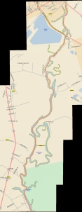
      When Sanctuary and crew made this side trip to Conway, in October, 2013, the daymarks in the river were in good condition. In December, 2013, the USCG announced plans to permanently discontinue the lateral daymarks on the upper Waccamaw River. There are, however, some large tributaries and embayments that intersect the river; some are large enough to be confusing to first time cruisers in the area. Since there are no NOAA charts of the upper Waccamaw that cover the River, I superimposed Sanctuary’sGPS track on a road map of the area. I hope this will be useful in portraying the through-route of the river to Conway.

      Southern Portion of Upper Waccamaw at Enterprise Landing, StM 375.

      Southern Portion of Upper Waccamaw at Enterprise Landing, StM 375.

      Clicking on these picture graphics will display them in a full-screen view. Further clicking will magnify them and allow scrolling. They are of high enough resolution that detail should be easily visible.

      Despite some facility limitations and walking-distance challenges, this river trip is exquisite. It is unique, beautiful and well worth the effort.

      Also see /?p=132447 for an earlier discussion of the Upper Waccamaw by the Healys.

      Comments from Cruisers (1)

      1. John Winter -  September 25, 2015 - 5:10 pm

        To hopefully complement Sanctuary’s posting, we just finished going to Conway and made the following notes. One can take these and mark the Healy’s maps, and add milage to them. the distances are not off more than a tenth at each junction: From ICW MM 375 just south of ICW marker “27A”:
        This is the last posting on any web sites that I have seen with any detail. We traveled this river this week and it is still a beautiful trip and well worth the extra time. It is even more beautiful than the lower Waccamaw. First, the Corps of Engineers have removed all markers above “R4”, and as such, there are a few spots that are confusing as to where to turn. Lastly, different postings on various web states the distance to downtown Conway anywhere from 12 to 16 miles without stating whether they are nautical or statute miles. Reset your odometer to “0” for the following information. We use statute miles. From “G1”, the entrance marker, it is 14.3 miles to the last bridge (you do not want to go under that in a larger boat) and about 14 miles to the marina entrance basin. Just as Sanctuary recommends, go to the bridge to dock since it is an easy walk to town. The two floating docks are in decent shape, but the cleats are still a little loose, but there is no traffic or winds to bother you and if there was a huge blow, there are alternatives to tie up soundly – easy. The electric is still there but still no water. Call the marina for space (room for a 60’ boat at each dock, maybe longer). Also, repeating, when going into a curve, stay to the outside where the water is deeper. We entered at dead low tide (on purpose) so as to make better notes. The NOAA charts that end just above “R4” are accurate. We saw 11-13’ at “G1” and then before the first curve, 7.9’. After the first curve, it deepened to 9.0’ Just prior to the second curve, briefly 5.9’, but we were too much inside on the curve. Coming back down, we had over 7.5’. Hug “R2”. First curve after “R2” was 8.3’. From here you will see depths well over 20’ in places. Just prior to “G3”, which is 1.9 miles in, 6.5’ and quickly deepens to 30’. MM 2.1 you’ll see many stumps on the RDB, but 8.1 feet as charted. MM 3.0 (“R4”) stay left at these intersections. MM 4.3, there are power lines that we do not know the height, but any motor boat will have no problems, but sailboats may (this statement applies to all power lines mentioned). They all appear to be well over 45′, but who knows. MM 4.7 at a private dock, make a left turn (it’s not obvious). MM 5.2 shallows to 8.6’ briefly. At MM 5.9, make a sharp left. MM 6.1, there are some nice homes to see, watch your wake. MM 6.9, favor RDB (starboard) for deeper water (7.5’, otherwise 6.0’). MM 7.6 some more homes. MM 9.4 is interesting. There is an upside down arrow sign that has the word “only” upside down on it. Do not think this sign is upside down, it’s not. Whoever put it up, obviously did not have the correct sign. Make a sharp left here (yes, to port). If you go right, you hit bottom (we know – LOL). MM 10.0, another left turn where there is yet another upside down “only” sign. MM 10.4-11.0, shallows to 7.4’ (this is where the river gets a little wider, so it makes sense the water would be shallower). MM 11.1 favor RDB where you get over 11’. Center is as low as 5.2’. MM 11.6, turn left. MM 12.1 is 6.6’ and there might be a very interesting river boat moored there. MM12.3, turn left at homes and docks. MM 13.2, overhead power lines. As you get to a high bridge, you are entering Conway. From here on in, it is no wake. You will see to your left the entrance to the marina basin around MM 13.9. Go past this to the floating docks on your left. They are obvious, just before the bridge. Call the marina for docking, but if no answer, don’t panic. If you are there just for a few hours, docking is free. The river walk is beautiful, and many great places to eat and shop. See the college (Coastal Carolina) – it is also very nice. One could easily stay here for a few days, so if the weather is not so good, and you have stopped at Georgetown enough, then this is the place for you. It takes about 2.5 hours (max) to do the river one way on a trawler.
        Sue and John Winter on Just Relax (MTOA, Golden Loopers, AICW members)

        Reply to John

    Social Media Auto Publish Powered By : XYZScripts.com